
Thank you for supporting this site ❤️
Make a donation
Make a donation
Bestensee topographic map
Click on the map to display elevation.
Thank you for supporting this site ❤️
Make a donation
Make a donation
About this map
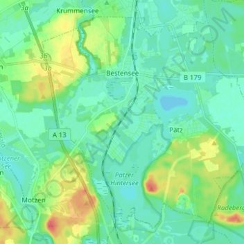
Name: Bestensee topographic map, elevation, terrain.
Location: Bestensee, Dahme-Spreewald, Brandenburg, 15741, Deutschland (52.19459 13.58721 52.26043 13.71105)
Average elevation: 44 m
Minimum elevation: 31 m
Maximum elevation: 82 m
Thank you for supporting this site ❤️
Make a donation
Make a donation