
Kasai River topographic map
Interactive map
Click on the map to display elevation.
About this map
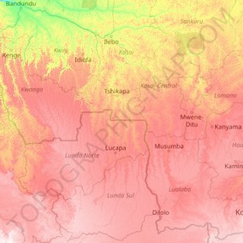
Name: Kasai River topographic map, elevation, terrain.
Location: Kasai River, Kasai, DR Congo (-11.58316 16.18504 -3.03284 22.32823)
Average elevation: 816 m
Minimum elevation: 284 m
Maximum elevation: 1,779 m