
Thank you for supporting this site ❤️
Make a donation
Make a donation
Okay topographic map
Click on the map to display elevation.
Thank you for supporting this site ❤️
Make a donation
Make a donation
About this map
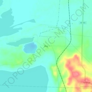
Name: Okay topographic map, elevation, terrain.
Location: Okay, Howard County, Arkansas, 71859, United States (33.74762 -93.94408 33.78762 -93.90408)
Average elevation: 90 m
Minimum elevation: 72 m
Maximum elevation: 146 m
Thank you for supporting this site ❤️
Make a donation
Make a donation
Other topographic maps
Click on a map to view its topography, its elevation and its terrain.