
Thank you for supporting this site ❤️
Make a donation
Make a donation
Birnin Kudu topographic map
Click on the map to display elevation.
Thank you for supporting this site ❤️
Make a donation
Make a donation
About this map
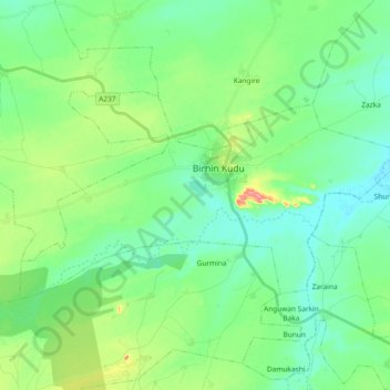
Name: Birnin Kudu topographic map, elevation, terrain.
Location: Birnin Kudu, Jigawa State, Nigeria (11.39020 9.38263 11.48731 9.56822)
Average elevation: 438 m
Minimum elevation: 409 m
Maximum elevation: 520 m
Thank you for supporting this site ❤️
Make a donation
Make a donation
Other topographic maps
Click on a map to view its topography, its elevation and its terrain.