
Thank you for supporting this site ❤️
Make a donation
Make a donation
Wheatfield topographic map
Click on the map to display elevation.
Thank you for supporting this site ❤️
Make a donation
Make a donation
About this map
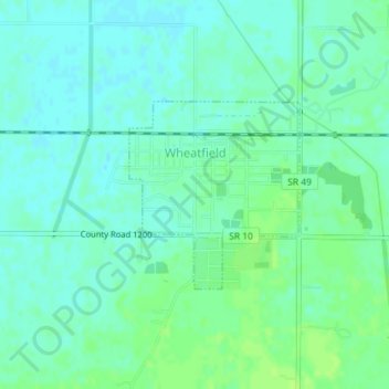
Name: Wheatfield topographic map, elevation, terrain.
Location: Wheatfield, Jasper County, Indiana, United States (41.18346 -87.06092 41.19648 -87.04517)
Average elevation: 203 m
Minimum elevation: 198 m
Maximum elevation: 209 m
Thank you for supporting this site ❤️
Make a donation
Make a donation