
Fresno de la Ribera topographic map
Click on the map to display elevation.
About this map
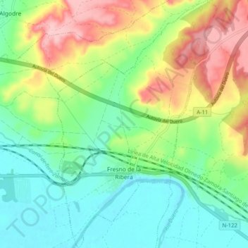
Name: Fresno de la Ribera topographic map, elevation, terrain.
Location: Fresno de la Ribera, Zamora, Castile and León, Spain (41.51086 -5.58906 41.56974 -5.53809)
Average elevation: 685 m
Minimum elevation: 628 m
Maximum elevation: 786 m
Other topographic maps
Click on a map to view its topography, its elevation and its terrain.