
Thank you for supporting this site ❤️
Make a donation
Make a donation
Kaligandaki topographic map
Click on the map to display elevation.
Thank you for supporting this site ❤️
Make a donation
Make a donation
About this map
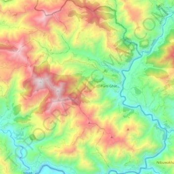
Name: Kaligandaki topographic map, elevation, terrain.
Location: Kaligandaki, Gulmi, Lumbini Province, Nepal (27.97396 83.47782 28.12634 83.60514)
Average elevation: 1,279 m
Minimum elevation: 470 m
Maximum elevation: 2,535 m
Thank you for supporting this site ❤️
Make a donation
Make a donation