
Thank you for supporting this site ❤️
Make a donation
Make a donation
Neustadt an der Orla topographic map
Click on the map to display elevation.
Thank you for supporting this site ❤️
Make a donation
Make a donation
About this map
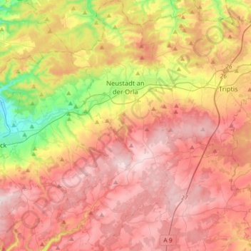
Name: Neustadt an der Orla topographic map, elevation, terrain.
Location: Neustadt an der Orla, Saale-Orla-Kreis, Thuringia, Germany (50.61809 11.66770 50.79902 11.84776)
Average elevation: 393 m
Minimum elevation: 192 m
Maximum elevation: 543 m
Thank you for supporting this site ❤️
Make a donation
Make a donation
Other topographic maps
Click on a map to view its topography, its elevation and its terrain.