
Thank you for supporting this site ❤️
Make a donation
Make a donation
Hay Lake topographic map
Click on the map to display elevation.
Thank you for supporting this site ❤️
Make a donation
Make a donation
About this map
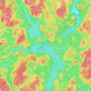
Name: Hay Lake topographic map, elevation, terrain.
Average elevation: 451 m
Minimum elevation: 395 m
Maximum elevation: 532 m
Thank you for supporting this site ❤️
Make a donation
Make a donation
Other topographic maps
Click on a map to view its topography, its elevation and its terrain.
Princes Lake
Canada > Ontario > Nipissing District > South Algonquin Township
Average elevation: 467 m
Bellwood
Canada > Ontario > Nipissing District > South Algonquin Township > Whitney
Average elevation: 410 m
Thank you for supporting this site ❤️
Make a donation
Make a donation
Madawaska Highlands
Canada > Ontario > Nipissing District > South Algonquin Township
Average elevation: 442 m
Whitelily Lake
Canada > Ontario > Nipissing District > South Algonquin Township
Average elevation: 389 m