
Thank you for supporting this site ❤️
Make a donation
Make a donation
Jonancy topographic map
Click on the map to display elevation.
Thank you for supporting this site ❤️
Make a donation
Make a donation
About this map
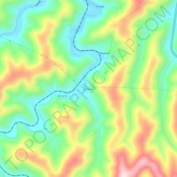
Name: Jonancy topographic map, elevation, terrain.
Location: Jonancy, Pike County, Kentucky, 41538, United States (37.29649 -82.60293 37.33649 -82.56293)
Average elevation: 399 m
Minimum elevation: 253 m
Maximum elevation: 619 m
Thank you for supporting this site ❤️
Make a donation
Make a donation
Other topographic maps
Click on a map to view its topography, its elevation and its terrain.