
Thank you for supporting this site ❤️
Make a donation
Make a donation
Galaha topographic map
Click on the map to display elevation.
Thank you for supporting this site ❤️
Make a donation
Make a donation
About this map
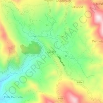
Name: Galaha topographic map, elevation, terrain.
Location: Galaha, Kandy District, Central Province, 20420, Sri Lanka (7.15777 80.62988 7.23777 80.70988)
Average elevation: 902 m
Minimum elevation: 471 m
Maximum elevation: 1,354 m
Thank you for supporting this site ❤️
Make a donation
Make a donation