
Thank you for supporting this site ❤️
Make a donation
Make a donation
Mörel topographic map
Click on the map to display elevation.
Thank you for supporting this site ❤️
Make a donation
Make a donation
About this map
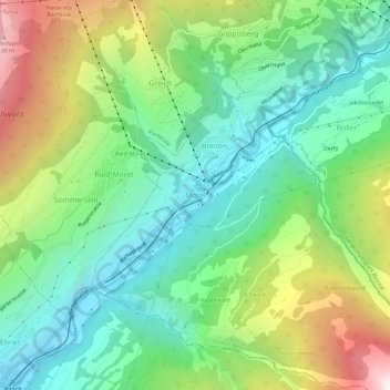
Name: Mörel topographic map, elevation, terrain.
Location: Mörel, Mörel-Filet, Östlich Raron, Wallis, 3983, Switzerland (46.33512 8.02436 46.37512 8.06436)
Average elevation: 1,244 m
Minimum elevation: 694 m
Maximum elevation: 2,336 m
Thank you for supporting this site ❤️
Make a donation
Make a donation