
Viedma-Gletscher topographic map
Interactive map
Click on the map to display elevation.
About this map
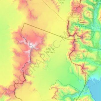
Name: Viedma-Gletscher topographic map, elevation, terrain.
Average elevation: 1,384 m
Minimum elevation: 246 m
Maximum elevation: 3,470 m
Other topographic maps
Click on a map to view its topography, its elevation and its terrain.
Monte Burney
Chile > XII Region von Magellan und der chilenischen Antarktis > Natales
Monte Burney, Natales, Provincia de Última Esperanza, XII Region von Magellan und der chilenischen Antarktis, Chile
Average elevation: 992 m