
Thank you for supporting this site ❤️
Make a donation
Make a donation
Sart-Eustache topographic map
Click on the map to display elevation.
Thank you for supporting this site ❤️
Make a donation
Make a donation
About this map
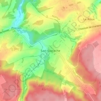
Name: Sart-Eustache topographic map, elevation, terrain.
Location: Sart-Eustache, Fosses-la-Ville, Namen, Wallonië, 5070, België (50.35607 4.57982 50.39607 4.61982)
Average elevation: 184 m
Minimum elevation: 117 m
Maximum elevation: 239 m
Thank you for supporting this site ❤️
Make a donation
Make a donation
Other topographic maps
Click on a map to view its topography, its elevation and its terrain.