
Thank you for supporting this site ❤️
Make a donation
Make a donation
Lamjung topographic map
Click on the map to display elevation.
Thank you for supporting this site ❤️
Make a donation
Make a donation
About this map
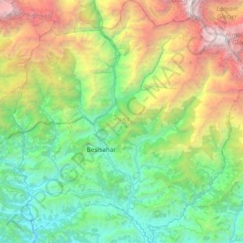
Name: Lamjung topographic map, elevation, terrain.
Location: Lamjung, Gandaki Province, Nepal (28.05558 84.18710 28.51005 84.69486)
Average elevation: 2,350 m
Minimum elevation: 361 m
Maximum elevation: 7,807 m
Thank you for supporting this site ❤️
Make a donation
Make a donation