
Goias topographic map
Interactive map
Click on the map to display elevation.
About this map
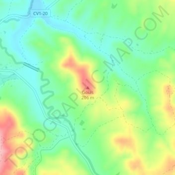
Name: Goias topographic map, elevation, terrain.
Average elevation: 125 m
Minimum elevation: 72 m
Maximum elevation: 218 m
Other topographic maps
Click on a map to view its topography, its elevation and its terrain.
Entrada da Barca
Portugal > Alentejo > São Teotónio > Entrada da Barca
Entrada da Barca, Zambujeira do Mar, São Teotónio, Odemira, Beja, Alentejo Litoral, Alentejo, 7630-777, Portugal
Average elevation: 28 m