
Irbid topographic map
Click on the map to display elevation.
About this map
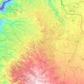
Name: Irbid topographic map, elevation, terrain.
Location: Irbid, حوارة, Irbid Qasabah District, Irbid, 21162, Jordan (32.39561 35.68930 32.71561 36.00930)
Average elevation: 512 m
Minimum elevation: -173 m
Maximum elevation: 1,131 m