
Thank you for supporting this site ❤️
Make a donation
Make a donation
Malinao topographic map
Click on the map to display elevation.
Thank you for supporting this site ❤️
Make a donation
Make a donation
Malinao
Malinao occupies a narrow stretch of plains hemmed in by the Lagonoy Gulf in the east and Mount Malinao on the west. The area is dominated by the mountain ranges of Malinao, with a peak altitude of 1,584 metres (5,197 ft) above sea level.
Thank you for supporting this site ❤️
Make a donation
Make a donation
About this map
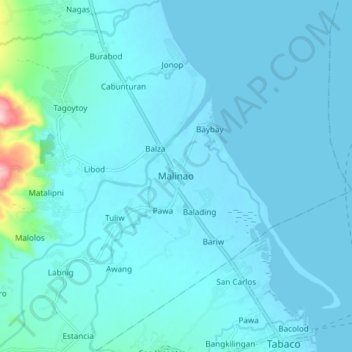
Name: Malinao topographic map, elevation, terrain.
Location: Malinao, Albay, Bicol Region, 4514, Philippines (13.35746 123.66498 13.43746 123.74498)
Average elevation: 17 m
Minimum elevation: -1 m
Maximum elevation: 217 m
Thank you for supporting this site ❤️
Make a donation
Make a donation
Other topographic maps
Click on a map to view its topography, its elevation and its terrain.