
Thank you for supporting this site ❤️
Make a donation
Make a donation
Hautes Pyrenees topographic map
Click on the map to display elevation.
Thank you for supporting this site ❤️
Make a donation
Make a donation
About this map
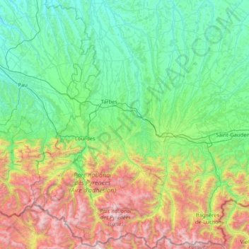
Name: Hautes Pyrenees topographic map, elevation, terrain.
Location: Hautes Pyrenees, Occitania, Metropolitan France, France (42.67418 -0.32723 43.61336 0.64614)
Average elevation: 820 m
Minimum elevation: 91 m
Maximum elevation: 3,280 m
Thank you for supporting this site ❤️
Make a donation
Make a donation