
East End topographic map
Click on the map to display elevation.
About this map
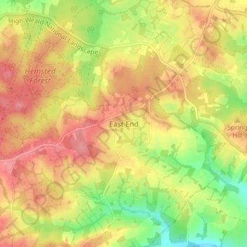
Name: East End topographic map, elevation, terrain.
Average elevation: 59 m
Minimum elevation: 11 m
Maximum elevation: 93 m
Other topographic maps
Click on a map to view its topography, its elevation and its terrain.
Rusthall Common Cricket Ground
United Kingdom > England > Kent > Tunbridge Wells > Rusthall
Average elevation: 99 m
Bedgebury National Pinetum
United Kingdom > England > Kent > Tunbridge Wells > Kilndown
Average elevation: 91 m
Scotney Castle
United Kingdom > England > Kent > Tunbridge Wells > Lamberhurst
Average elevation: 66 m
Underground reservoir
United Kingdom > England > Kent > Tunbridge Wells > Hartley > Flishinghurst
Average elevation: 103 m