
Thank you for supporting this site ❤️
Make a donation
Make a donation
Gelora Park topographic map
Click on the map to display elevation.
Thank you for supporting this site ❤️
Make a donation
Make a donation
About this map
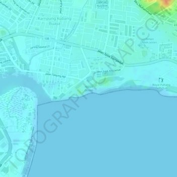
Name: Gelora Park topographic map, elevation, terrain.
Location: Gelora Park, Kampung Kubang Buaya, Kuantan, Pahang, Malaysia (3.80632 103.34535 3.81006 103.35510)
Average elevation: 4 m
Minimum elevation: -1 m
Maximum elevation: 44 m
Thank you for supporting this site ❤️
Make a donation
Make a donation
Other topographic maps
Click on a map to view its topography, its elevation and its terrain.