
Thank you for supporting this site ❤️
Make a donation
Make a donation
East Hanningfield topographic map
Click on the map to display elevation.
Thank you for supporting this site ❤️
Make a donation
Make a donation
About this map
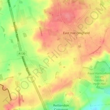
Name: East Hanningfield topographic map, elevation, terrain.
Location: East Hanningfield, Chelmsford, Essex, England, United Kingdom (51.65424 0.52545 51.69440 0.57551)
Average elevation: 47 m
Minimum elevation: 9 m
Maximum elevation: 73 m
Thank you for supporting this site ❤️
Make a donation
Make a donation
Other topographic maps
Click on a map to view its topography, its elevation and its terrain.