
Thank you for supporting this site ❤️
Make a donation
Make a donation
Yampa topographic map
Click on the map to display elevation.
Thank you for supporting this site ❤️
Make a donation
Make a donation
About this map
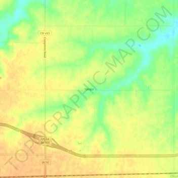
Name: Yampa topographic map, elevation, terrain.
Location: Yampa, Wapello County, Iowa, United States (40.99002 -92.24379 41.03002 -92.20379)
Average elevation: 236 m
Minimum elevation: 216 m
Maximum elevation: 246 m
Thank you for supporting this site ❤️
Make a donation
Make a donation
Other topographic maps
Click on a map to view its topography, its elevation and its terrain.