
Björktorp topographic map
Interactive map
Click on the map to display elevation.
About this map
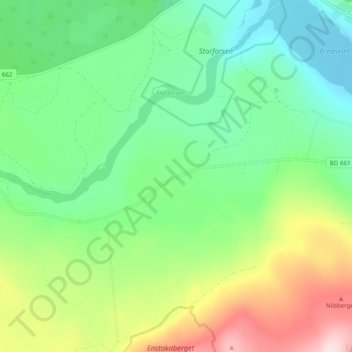
Name: Björktorp topographic map, elevation, terrain.
Location: Björktorp, Älvsbyns kommun, Provinz Norrbotten, Schweden (65.81546 20.36989 65.85546 20.40989)
Average elevation: 147 m
Minimum elevation: 40 m
Maximum elevation: 365 m