
Thank you for supporting this site ❤️
Make a donation
Make a donation
Jaken topographic map
Click on the map to display elevation.
Thank you for supporting this site ❤️
Make a donation
Make a donation
About this map
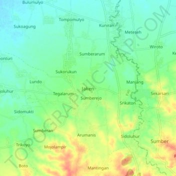
Name: Jaken topographic map, elevation, terrain.
Location: Jaken, Pati, Central Java, Java, Indonesia (-6.81347 111.18367 -6.73347 111.26367)
Average elevation: 26 m
Minimum elevation: 7 m
Maximum elevation: 60 m
Thank you for supporting this site ❤️
Make a donation
Make a donation