
Thank you for supporting this site ❤️
Make a donation
Make a donation
Les Planesteles topographic map
Click on the map to display elevation.
Thank you for supporting this site ❤️
Make a donation
Make a donation
About this map
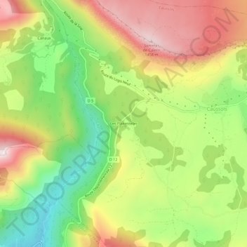
Name: Les Planesteles topographic map, elevation, terrain.
Average elevation: 1,153 m
Minimum elevation: 864 m
Maximum elevation: 1,468 m
Thank you for supporting this site ❤️
Make a donation
Make a donation
Other topographic maps
Click on a map to view its topography, its elevation and its terrain.
Téléscope de Schmidt
France > Provence-Alpes-Côte d'Azur > Alpes-Maritimes > Caussols > Cresp
Average elevation: 1,184 m