
Thank you for supporting this site ❤️
Make a donation
Make a donation
Tvååker topographic map
Click on the map to display elevation.
Thank you for supporting this site ❤️
Make a donation
Make a donation
About this map
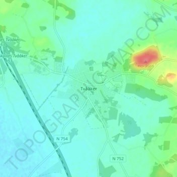
Name: Tvååker topographic map, elevation, terrain.
Location: Tvååker, Varbergs kommun, Provinz Halland, 432 78, Schweden (57.02136 12.37911 57.06136 12.41911)
Average elevation: 18 m
Minimum elevation: 5 m
Maximum elevation: 73 m
Thank you for supporting this site ❤️
Make a donation
Make a donation
Other topographic maps
Click on a map to view its topography, its elevation and its terrain.