
Make a donation
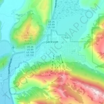
Jackson topographic map
Click on the map to display elevation.
Make a donation
Jackson
Jackson is located at an elevation of 6,237 feet (1,901 m) above sea level. According to the United States Census Bureau, the town has a total area of 3.009 square miles (7.79 km2), of which 2.978 square miles (7.71 km2) is land and 0.031 square miles (0.08 km2) (1.03%) is water.
Make a donation
About this map
Name: Jackson topographic map, elevation, terrain.
Location: Jackson, Teton County, Wyoming, United States (43.45819 -110.81343 43.49046 -110.73764)
Average elevation: 2,043 m
Minimum elevation: 1,857 m
Maximum elevation: 2,511 m
Make a donation
Other topographic maps
Click on a map to view its topography, its elevation and its terrain.
Rocky Mountains
United States > Wyoming > Teton County
Agriculture and forestry are major industries. Agriculture includes dryland and irrigated farming and livestock grazing. Livestock are frequently moved between high-elevation summer pastures and low-elevation winter pastures, a practice known as transhumance.
Average elevation: 2,292 m
Buck Mountain
United States > Wyoming > Teton County
Buck Mountain (elevation: 11,943 feet (3,640 m)) is a mountain located in the Teton Range, Grand Teton National Park, Wyoming, immediately southeast of Grand Teton.
Average elevation: 3,128 m
Rocky Mountains
United States > Wyoming > Teton County
Agriculture and forestry are major industries. Agriculture includes dryland and irrigated farming and livestock grazing. Livestock are frequently moved between high-elevation summer pastures and low-elevation winter pastures, a practice known as transhumance.
Average elevation: 2,292 m
Make a donation
Make a donation
Teton Range
United States > Wyoming > Teton County
One reason the Teton Range is famous is because of the dramatic elevation profile visible from the eastern side, which rises sharply from 4,000 to 7,000 feet (1,200–2,100 m) above the valley floor. Unlike most mountain ranges, the east side of the Teton Range lacks significant foothills or lower peaks which…
Average elevation: 2,985 m
Make a donation
Jenny Lake
United States > Wyoming > Teton County
Jenny Lake is a starting point for many day and overnight hiking trips. The 7.1-mile (11.4 km) Jenny Lake Trail loops around the lake and is considered to be relatively easy due to the small altitude gain of 700 feet (210 m). However, the altitude increases rapidly once Cascade Canyon is entered.
Average elevation: 2,109 m
Make a donation
Togwotee Pass
United States > Wyoming > Teton County
Togwotee Pass (pronounced TOH-guh-tee) is a high mountain pass in the western United States, at an elevation of 9,655 feet (2,943 m) above sea level. On the Continental Divide in the Absaroka Range of northwestern Wyoming in Teton County, it is between Dubois and Moran Junction in the Jackson Hole valley.
Average elevation: 2,965 m
Rocky Mountains
United States > Wyoming > Teton County
Agriculture and forestry are major industries. Agriculture includes dryland and irrigated farming and livestock grazing. Livestock are frequently moved between high-elevation summer pastures and low-elevation winter pastures, a practice known as transhumance.
Average elevation: 2,292 m
Make a donation
Buck Mountain
United States > Wyoming > Teton County
Buck Mountain (elevation: 11,943 feet (3,640 m)) is a mountain located in the Teton Range, Grand Teton National Park, Wyoming, immediately southeast of Grand Teton.
Average elevation: 3,128 m
Make a donation
Make a donation
Make a donation
Make a donation
Upper Geyser Basin
United States > Wyoming > Teton County > Upper Geyser Basin
Average elevation: 2,295 m
Make a donation