
Thank you for supporting this site ❤️
Make a donation
Make a donation
Oak Trail Shores topographic map
Click on the map to display elevation.
Thank you for supporting this site ❤️
Make a donation
Make a donation
About this map
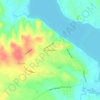
Name: Oak Trail Shores topographic map, elevation, terrain.
Location: Oak Trail Shores, Hood County, Texas, United States (32.46875 -97.85420 32.50875 -97.81420)
Average elevation: 231 m
Minimum elevation: 211 m
Maximum elevation: 271 m
Thank you for supporting this site ❤️
Make a donation
Make a donation
Other topographic maps
Click on a map to view its topography, its elevation and its terrain.