
容县 topographic map
Interactive map
Click on the map to display elevation.
About this map
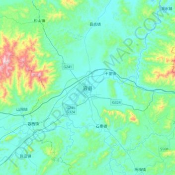
Name: 容县 topographic map, elevation, terrain.
Location: 容县, 玉林市, 广西壮族自治区, 543000, 中国 (22.70116 110.39368 23.02116 110.71368)
Average elevation: 202 m
Minimum elevation: 54 m
Maximum elevation: 979 m
Other topographic maps
Click on a map to view its topography, its elevation and its terrain.