
La Orotava topographic map
Interactive map
Click on the map to display elevation.
About this map
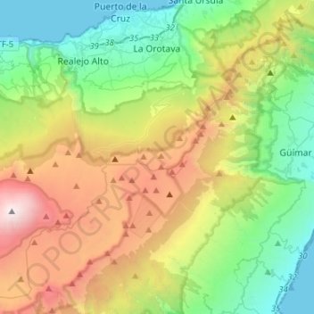
Name: La Orotava topographic map, elevation, terrain.
Location: La Orotava, Santa Cruz de Tenerife, Canary Islands, Spain (28.19873 -16.68387 28.42427 -16.46357)
Average elevation: 1,257 m
Minimum elevation: 0 m
Maximum elevation: 3,685 m