
Mount Washington topographic map
Interactive map
Click on the map to display elevation.
About this map
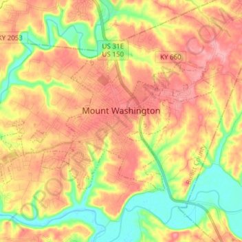
Name: Mount Washington topographic map, elevation, terrain.
Location: Mount Washington, Bullitt County, Kentucky, 40047, USA (38.01794 -85.62239 38.07328 -85.49862)
Average elevation: 184 m
Minimum elevation: 131 m
Maximum elevation: 228 m