Geolocate

Delaware County topographic map

Interactive map

Click on the map to display elevation.

About this map

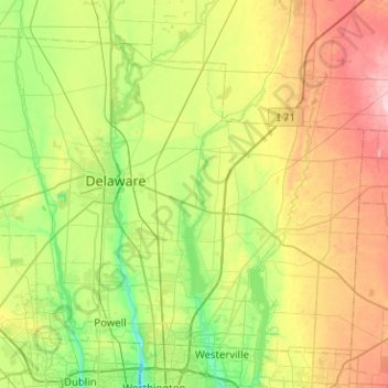
Name: Delaware County topographic map, elevation, terrain.

Location: Delaware County, Ohio, USA (40.12593 -83.24973 40.44393 -82.74493)

Average elevation: 302 m

Minimum elevation: 230 m

Maximum elevation: 432 m

Other topographic maps

Click on a map to view its topography, its elevation and its terrain.

Massillon

USA > Ohio > Massillon

Average elevation: 321 m

Pleasant Heights

USA > Ohio > Pleasant Heights

Average elevation: 300 m

Fairfield County

USA > Ohio

Average elevation: 282 m

Highland County

USA > Ohio

Average elevation: 305 m

New Harrisburg

USA > Ohio > New Harrisburg

Average elevation: 354 m

Burton Lake

USA > Ohio > Burton Lake

Average elevation: 348 m

Sherman Island

USA > Ohio

Average elevation: 294 m

Lake Erie

USA > Ohio

Average elevation: 267 m