
Tongoa topographic map
Interactive map
Click on the map to display elevation.
Tongoa
Tongoa is the largest island of Shepherd Islands archipelago. The island is heavily vegetated and shows geothermal activity. Tongoa is of recent volcanic origin but currently has no currently active volcano. There are numerous volcanic cones on the island and some black sand beaches. The estimated terrain elevation above the sea level is some 191 metres. There is an airport on the island – Tongoa Airport (TGH).
About this map
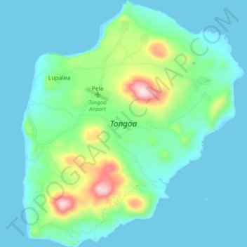
Name: Tongoa topographic map, elevation, terrain.
Location: Tongoa, Euta, Shefa Province, Vanuatu (-16.93676 168.52731 -16.86241 168.59746)
Average elevation: 89 m
Minimum elevation: -11 m
Maximum elevation: 479 m