
Thank you for supporting this site ❤️
Make a donation
Make a donation
Hartman topographic map
Click on the map to display elevation.
Thank you for supporting this site ❤️
Make a donation
Make a donation
About this map
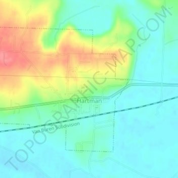
Name: Hartman topographic map, elevation, terrain.
Location: Hartman, Johnson County, Arkansas, United States (35.42484 -93.63872 35.44386 -93.60804)
Average elevation: 126 m
Minimum elevation: 102 m
Maximum elevation: 177 m
Thank you for supporting this site ❤️
Make a donation
Make a donation
Other topographic maps
Click on a map to view its topography, its elevation and its terrain.
Thank you for supporting this site ❤️
Make a donation
Make a donation
Thank you for supporting this site ❤️
Make a donation
Make a donation