
Thank you for supporting this site ❤️
Make a donation
Make a donation
Pine Cobble topographic map
Click on the map to display elevation.
Thank you for supporting this site ❤️
Make a donation
Make a donation
About this map
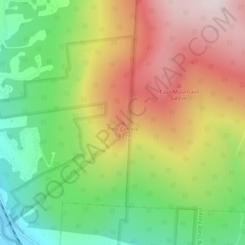
Name: Pine Cobble topographic map, elevation, terrain.
Average elevation: 426 m
Minimum elevation: 180 m
Maximum elevation: 697 m
Thank you for supporting this site ❤️
Make a donation
Make a donation
Other topographic maps
Click on a map to view its topography, its elevation and its terrain.
Clover Hill Farm Conservation Area
United States > Massachusetts > Berkshire County > Williamstown > Meadowvale
Average elevation: 217 m
Mountain Meadow Preserve
United States > Massachusetts > Berkshire County > Williamstown
Average elevation: 267 m