Luanda Province topographic map
Click on the map to display elevation.
About this map

Name: Luanda Province topographic map, elevation, terrain.
Location: Luanda Province, Angola (-10.45624 12.78978 -8.58002 14.62167)
Average elevation: 86 m
Minimum elevation: -2 m
Maximum elevation: 1,170 m
Other topographic maps
Click on a map to view its topography, its elevation and its terrain.


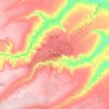






Huambo
The construction of the railway initially advanced with great difficulty, due to the ruggedness of the terrain, the prevalence of malaria and, to some extent, the resistance of the natives. Huambo was found to be a strategic place for many reasons. A benign climate (greatly due to its high altitude, 1,700m)…
Average elevation: 1,668 m


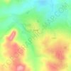
Calulo
Calulo [kɐˈlulu] is a town, with a population of 44,000 (2014), and a commune in the municipality of Libolo, province of Cuanza Sul, Angola and the seat of the municipality. The town stands at an altitude of 990 m (3,250 ft) above sea level.
Average elevation: 981 m






Calulo
Calulo [kɐˈlulu] is a town, with a population of 44,000 (2014), and a commune in the municipality of Libolo, province of Cuanza Sul, Angola and the seat of the municipality. The town stands at an altitude of 990 m (3,250 ft) above sea level.
Average elevation: 981 m







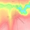
Cuito
The town sits on the eastern flank of the Bie Plateau. Due to its elevation, the climate is unusually cool for its tropical location with an average annual temperature is 18 °C. The coolest period is May to August when almost no rain falls. September and October are the hottest months with a little rain.…
Average elevation: 1,673 m






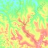
Lubango
Angola > Huíla Province > Lubango > Lubango
In 1882 approximately one thousand Portuguese settlers came from the island of Madeira to the area of current-day Lubango. These Portuguese farmers helped develop the region and founded the settlement. The city, originally established in 1885 to serve colonists from the Madeira Islands, lies at an elevation of…
Average elevation: 1,826 m