
Littoral topographic map
Interactive map
Click on the map to display elevation.
About this map
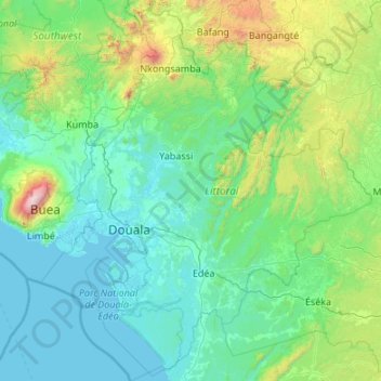
Name: Littoral topographic map, elevation, terrain.
Location: Littoral, Cameroon (3.18785 9.20522 5.33501 11.07749)
Average elevation: 383 m
Minimum elevation: -2 m
Maximum elevation: 3,987 m
Other topographic maps
Click on a map to view its topography, its elevation and its terrain.