
Thank you for supporting this site ❤️
Make a donation
Make a donation
Königsdorf topographic map
Click on the map to display elevation.
Thank you for supporting this site ❤️
Make a donation
Make a donation
Königsdorf
Charakteristisch für Königsdorf ist der westlich gelegene Königsdorfer Forst und die vielfältige Anbindung an den Westen der Nachbarstadt Köln. Im Norden liegen die Glessener Höhe und die Stadt Pulheim mit dem Ortsteil Brauweiler, westlich von Königsdorf liegen die Städte Kerpen und Bergheim.
Thank you for supporting this site ❤️
Make a donation
Make a donation
About this map
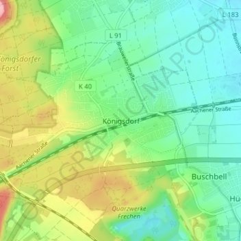
Name: Königsdorf topographic map, elevation, terrain.
Average elevation: 100 m
Minimum elevation: 58 m
Maximum elevation: 184 m
Thank you for supporting this site ❤️
Make a donation
Make a donation
Other topographic maps
Click on a map to view its topography, its elevation and its terrain.