
Thank you for supporting this site ❤️
Make a donation
Make a donation
Zündorf topographic map
Click on the map to display elevation.
Thank you for supporting this site ❤️
Make a donation
Make a donation
Zündorf
Jährlich ab Christi Himmelfahrt wird von der CDU das viertägige Porzer Inselfest an der Groov veranstaltet. Neben einem Volksfest mit Fahrgeschäften wird ein historischer Handwerkermarkt sowie ein Kinderflohmarkt und zum Abschluss ein Höhenfeuerwerk durchgeführt.
Thank you for supporting this site ❤️
Make a donation
Make a donation
About this map
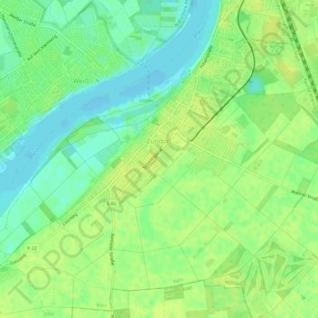
Name: Zündorf topographic map, elevation, terrain.
Location: Zündorf, Porz, Köln, Nordrhein-Westfalen, 51143, Deutschland (50.84885 7.01723 50.87885 7.07457)
Average elevation: 51 m
Minimum elevation: 41 m
Maximum elevation: 58 m
Thank you for supporting this site ❤️
Make a donation
Make a donation
Other topographic maps
Click on a map to view its topography, its elevation and its terrain.