
Metz topographic map
Click on the map to display elevation.
About this map
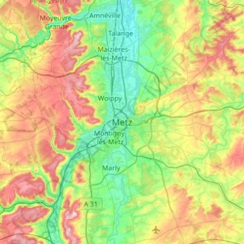
Name: Metz topographic map, elevation, terrain.
Location: Metz, Moselle, Grand Est, France métropolitaine, 57045, France (48.95970 6.01636 49.27970 6.33636)
Average elevation: 244 m
Minimum elevation: 154 m
Maximum elevation: 406 m
Other topographic maps
Click on a map to view its topography, its elevation and its terrain.