
Thank you for supporting this site ❤️
Make a donation
Make a donation
Denmark topographic map
Click on the map to display elevation.
Thank you for supporting this site ❤️
Make a donation
Make a donation
About this map
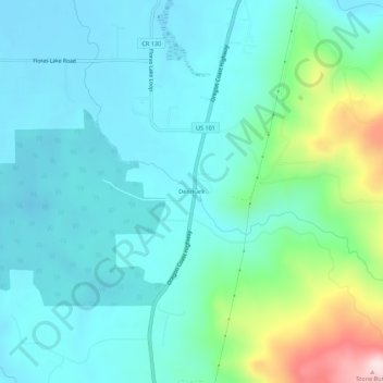
Name: Denmark topographic map, elevation, terrain.
Location: Denmark, Curry County, Oregon, 97450, United States (42.87066 -124.48261 42.91066 -124.44261)
Average elevation: 90 m
Minimum elevation: 5 m
Maximum elevation: 431 m
Thank you for supporting this site ❤️
Make a donation
Make a donation
Other topographic maps
Click on a map to view its topography, its elevation and its terrain.