
Thank you for supporting this site ❤️
Make a donation
Make a donation
Agung topographic map
Click on the map to display elevation.
Thank you for supporting this site ❤️
Make a donation
Make a donation
About this map
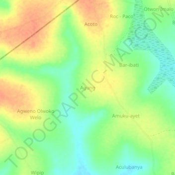
Name: Agung topographic map, elevation, terrain.
Location: Agung, Kole, Northern Region, Uganda (2.39255 32.67867 2.43255 32.71867)
Average elevation: 1,088 m
Minimum elevation: 1,065 m
Maximum elevation: 1,110 m
Thank you for supporting this site ❤️
Make a donation
Make a donation