
鹿寨县 topographic map
Interactive map
Click on the map to display elevation.
About this map
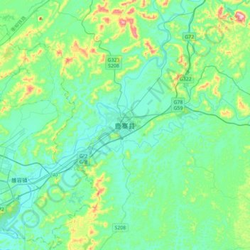
Name: 鹿寨县 topographic map, elevation, terrain.
Location: 鹿寨县, 柳州市, 广西壮族自治区, 中国 (24.31586 109.58598 24.63586 109.90598)
Average elevation: 146 m
Minimum elevation: 68 m
Maximum elevation: 477 m
Other topographic maps
Click on a map to view its topography, its elevation and its terrain.