
和平区 topographic map
Interactive map
Click on the map to display elevation.
About this map
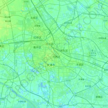
Name: 和平区 topographic map, elevation, terrain.
Location: 和平区, 天津市, 300040, 中国 (38.95600 117.04841 39.27600 117.36841)
Average elevation: 4 m
Minimum elevation: -5 m
Maximum elevation: 20 m
和平区位于北纬39°8′东经117°12′。境内以平原为主,地势平坦,海拔为2.8米至4.5米。
Other topographic maps
Click on a map to view its topography, its elevation and its terrain.