
Thank you for supporting this site ❤️
Make a donation
Make a donation
Yola South topographic map
Click on the map to display elevation.
Thank you for supporting this site ❤️
Make a donation
Make a donation
About this map
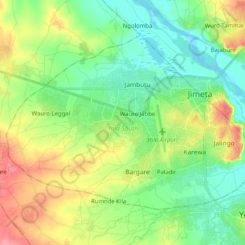
Name: Yola South topographic map, elevation, terrain.
Location: Yola South, Adamawa State, Nigeria (9.21180 12.34087 9.31118 12.48208)
Average elevation: 181 m
Minimum elevation: 150 m
Maximum elevation: 237 m
Thank you for supporting this site ❤️
Make a donation
Make a donation
Other topographic maps
Click on a map to view its topography, its elevation and its terrain.