
Banks Island topographic map
Interactive map
Click on the map to display elevation.
About this map
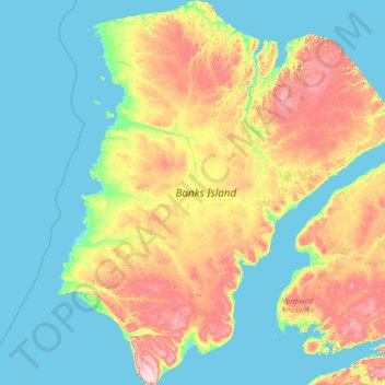
Name: Banks Island topographic map, elevation, terrain.
Location: Banks Island, Inuvik Region, Northwest Territories, Canada (71.07891 -126.00703 74.56000 -115.29025)
Average elevation: 90 m
Minimum elevation: -1 m
Maximum elevation: 689 m
Other topographic maps
Click on a map to view its topography, its elevation and its terrain.