
Thank you for supporting this site ❤️
Make a donation
Make a donation
Cumberland topographic map
Click on the map to display elevation.
Thank you for supporting this site ❤️
Make a donation
Make a donation
About this map
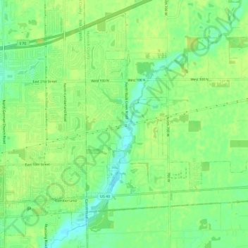
Name: Cumberland topographic map, elevation, terrain.
Location: Cumberland, Hancock County, Indiana, United States (39.77000 -85.97129 39.80941 -85.91406)
Average elevation: 261 m
Minimum elevation: 251 m
Maximum elevation: 266 m
Thank you for supporting this site ❤️
Make a donation
Make a donation
Other topographic maps
Click on a map to view its topography, its elevation and its terrain.
Thank you for supporting this site ❤️
Make a donation
Make a donation
Thank you for supporting this site ❤️
Make a donation
Make a donation
Thank you for supporting this site ❤️
Make a donation
Make a donation
Thank you for supporting this site ❤️
Make a donation
Make a donation