
Yangzhou City topographic map
Interactive map
Click on the map to display elevation.
About this map
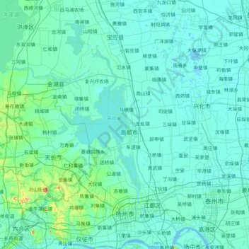
Name: Yangzhou City topographic map, elevation, terrain.
Location: Yangzhou City, Jiangsu, China (32.22463 119.00460 33.41710 119.90340)
Average elevation: 10 m
Minimum elevation: -2 m
Maximum elevation: 210 m
Other topographic maps
Click on a map to view its topography, its elevation and its terrain.