
Thank you for supporting this site ❤️
Make a donation
Make a donation
Shikaripura topographic map
Click on the map to display elevation.
Thank you for supporting this site ❤️
Make a donation
Make a donation
Shikaripura
Shikaripur is located at 14°16′N 75°21′E / 14.27°N 75.35°E / 14.27; 75.35. It has an average elevation of 603 m (1978 ft). It lies on tropical forests of Malenadu region. Shikaripura is one of the junction to connect north karnataka to Malenadu. And the river kumadvati flows from the town and nearest dams anjanapura and ambligola, nearest tourist places balligavi,udutadi,jogfalls,lionsafori,agumbe,koodachadri,kavaledurga fort,bhadra river project, gajnur dam , sakrebaylu.
Thank you for supporting this site ❤️
Make a donation
Make a donation
About this map
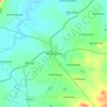
Name: Shikaripura topographic map, elevation, terrain.
Average elevation: 610 m
Minimum elevation: 580 m
Maximum elevation: 716 m
Thank you for supporting this site ❤️
Make a donation
Make a donation